


Zumbrota W-2, Goodhue County, Minnesota
About
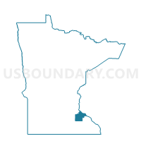
Outline

Summary
| Unique Area Identifier | 602022 |
| Name | Zumbrota W-2 |
| County | Goodhue County |
| State | Minnesota |
| Area (square miles) | 1.82 |
| Land Area (square miles) | 1.82 |
| Water Area (square miles) | 0.00 |
| % of Land Area | 99.97 |
| % of Water Area | 0.03 |
| Latitude of the Internal Point | 44.29541190 |
| Longtitude of the Internal Point | -92.67729650 |
Maps


Graphs
Select a template below for downloading or customizing gragh for Zumbrota W-2, Goodhue County, Minnesota


Neighbors
Neighoring Voting District (by Name) Neighboring Voting District on the Map
- Minneola Twp. Voting District, Goodhue County, MN
- Pine Island Twp. Voting District, Goodhue County, MN
- Roscoe Twp. Voting District, Goodhue County, MN
- Zumbrota Twp. Voting District, Goodhue County, MN
- Zumbrota W-1, Goodhue County, MN
Top 10 Neighboring County Subdivision (by Population) Neighboring County Subdivision on the Map
- Zumbrota city, Goodhue County, MN (3,252)
- Roscoe township, Goodhue County, MN (732)
- Minneola township, Goodhue County, MN (629)
- Zumbrota township, Goodhue County, MN (586)
- Pine Island township, Goodhue County, MN (551)